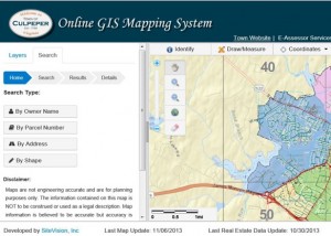
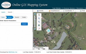
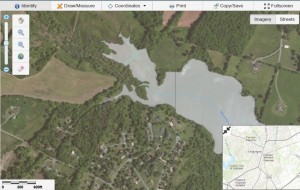
Roanoke, VA January 18, 2014: The Town of Culpeper, VA has formally launched its new online GIS System (http://townofculpeperva.gisbrowser.com). SiteVision, Inc. (http://www.sitevision.com) is providing the new GIS system as software as a service (SAAS) under a Commonwealth of Virginia Hosting Contract which is available to all public agencies (local, regional, state), and to other states as well. SiteVision developed the site to be cross-platform compatible and accessible via mobile devices.
 Prior to selecting SiteVision, Inc. as its SaaS/hosting vendor, The Town of Culpeper GIS and IT Department surveyed the needs of its residents and system stakeholders. The Town then outlined the necessary and most requested mapping functions, layers, data sources, reports, tools, etc. to be required in their new online GIS system.
SiteVision first began working with the Town to help establish CAD and GIS data interoperability standards, maintenance procedures, and to create and test related Internet map services. These initial tasks\services were contracted by the Town to SiteVision, Inc. through the Commonwealth of Virginia’s IT Contingent Labor Contract.
The Town of Culpeper’s new system utilizes more than 30 map services from several sources including SiteVision, Inc., the Town of Culpeper, Culpeper County, Environmental Systems Research Institute, Inc. (ESRI), and the Commonwealth of Virginia. The Town maintains all of their own GIS and CAD data and uploads their data updates to the new online GIS system at least once a month.
 Users may query and access real estate tax and assessment database record(s) and related tax map parcels, download property cards, and view points of Interest (Police, Fire, Schools, etc.) with notes and links to more information. The user can draw and measure features on the map, locate GPS points or coordinates, and save, copy or print a custom map. The system also allows users to download reports and tables in Adobe or MS Excel format.
 “We tried to incorporate the most requested new features into the project,” said GIS coordinator Autumn Fitch. “The biggest thing is that it is cross compatible with so many browsers.” –Star Exponent, Posted: Tuesday, November 12, 2013 12:15 am | Updated: 6:29 am, Tue Nov 12, 2013.
The overall project stayed within the existing GIS budget with no additional costs to taxpayers, according to the town. –Star Exponent, Posted: Tuesday, November 12, 2013 12:15 am | Updated: 6:29 am, Tue Nov 12, 2013.
Daniel Shaffer, Director, Geospatial Division for SiteVision, added “With today’s economy, many public agencies are stuck in legacy online GIS systems with no foreseeable way out. Our SaaS plans allow public agencies to migrate to the latest systems while spending little to no upfront fees or costs. The agency pays for the SaaS service on a flexible monthly, quarterly or yearly schedule.”
“It was a privilege working with the Town of Culpeper,” said Patrick Maddox, CEO of SiteVision. “They did a careful assessment of their needs and were highly professional to work with. The result is an outstanding GIS system designed with the most recent features available.”
SiteVision, Inc. (www.sitevision.com) is an Internet application development, consulting, design and hosting firm providing solutions for a broad spectrum of markets and industries, as well as for state, federal and international entities. Expertise includes custom, back-end dynamic applications, consulting to achieve unique goals, geographic information systems (GIS), content management systems, hosting services including, map and GIS application hosting, as well as custom and dedicated hosting solutions.
SiteVision, Inc. participates in, or is available through, the following state and federal contracting vehicles:
The firm has its home office in Roanoke, VA, with sales offices in Charlottesville, VA and Miami, FL.


